The vital statistics of standing waters in the United Kingdom
7 February, 2024
By Stephen C. Maberly (1), Laurence Carvalho (2) and Philip J Taylor (3)
(1) UK Centre for Ecology & Hydrology (UKCEH), email: scm@ceh.ac.uk; (2) Norwegian Institute for Water Research (NIVA), email: laurence.carvalho@niva.no (3) UK Centre for Ecology & Hydrology, email: philor@ceh.ac.uk
Stephen started studying lake ecology in 1978 and in retirement is now a Fellow of UKCEH as well as the Freshwater Biological Association. Laurence, also an FBA Fellow, has worked on lakes across the UK and recently moved to Norway. Philip is a data scientist who works with lakes and catchments and manages the UK Lakes Portal. This article uses data within the UK Lakes Portal to describe the abundance, distribution and size of UK standing waters.
Edited by Rachel Stubbington, Nottingham Trent University
Rachel is both a Fellow of the Freshwater Biological Association and long-standing Editor of FBA articles. If you would like to submit an article for consideration for publication, please contact Rachel at: rachel.stubbington@ntu.ac.uk
Introduction
The UK Lakes Portal (https://eip.ceh.ac.uk/apps/lakes/) contains information on nearly 42,000 UK waterbodies that are larger than ~0.01 ha (0.0001 km2). The Portal includes information on morphology (such as area, perimeter length, elevation), typology (in relation to the Water Framework Directive), water chemistry (such as alkalinity, conductivity and many other determinands) and, for lakes >0.01 km2, catchment data (e.g. land cover classes and connectivity within the catchment).
It also includes information relevant to environment and conservation agencies, and links to external sources of data on freshwater biodiversity and bathymetric maps.
It was produced by staff at University College London, UKCEH and the Environment Agency in the early 2000s (Hughes et al., 2004), is now hosted by UKCEH and is searchable from the Portal website, with the spatial data being available for download under an OGL licence (Taylor, 2021).
For Northern Ireland, only lakes >0.5 km2 (28 lakes) are currently included. In this analysis, data for Northern Ireland were obtained from an inventory of 1668 sites (Smith et al., 1991) instead of the Portal, although it lacks much of the ancillary information that the portal provides. Standing waters are highly valued elements of the UK landscape and provide people with a range of benefits as well as being important hotspots for biodiversity and carbon and nutrient processing (Schallenberg et al., 2013). This article uses data from the Portal to describe the stock and distribution of UK standing waters.
The distribution and characteristics of UK standing waters
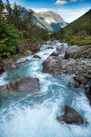
Of the 43,470 documented UK standing waters, 61% are in Scotland and 35% are in England with the remainder in Northern Ireland and Wales (Table 1). Scotland contains 57% of the standing water area, followed by 21% in Northern Ireland, the latter reflecting Lough Neagh and the two basins of Lough Erne, the UK’s largest standing waters by area. Scotland’s Loch Morar (Fig.1) is the UK’s deepest standing water and Loch Ness has the greatest volume.
Table 1. UK standing waters larger than 0.0001 km2.


Figure 1. Major lakes in each UK nation. A, Windermere, England; B, Lough Erne, Northern Ireland; C, Loch Morar, Scotland; D, Llyn Tegid, Wales. Photo credits: A, Laurence Carvalho; B, Jon Sullivan; C, Ian Winfield; D, Mecrothesp at the English-language Wikipedia, CC BY-SA 3.0, https://commons.wikimedia.org/w/index.php?curid=10513322
The area of standing waters varies by over six orders of magnitude (Fig. 2A) with a median area of only 0.005 km2, emphasising the numerical dominance of small standing waterbodies. In total, 94% of sites are <0.1 km2 and only 0.6% (255) are >1 km2 in area. Site elevation varies over three orders of magnitude from <0 m for a few sites (mainly in Essex, Norfolk and Cambridgeshire) to 1215 m (a small unnamed lochan in the Cairngorms of Scotland Fig. 2B). The median elevation is 88 m and 90% of sites are at an elevation of 10–1000 m. Sites at the highest elevations are all small and those with the greatest area are all at low elevations (Fig. 2C).

Figure 2. Area and elevation of standing waters in the UK. A, Ranked area; the inset shows numbers in different size categories. B, Ranked elevation; the inset shows numbers in different elevation categories. C, Relationship between elevation and area.
UK standing waters cover ~1.2% of the land area (Table 1) that is lower than the global average of 2.2% despite a larger area cutoff (0.01 km2) for the latter (Messager et al. 2016), while England and Wales have an even lower coverage of ~0.4%. Standing waters are most numerous in parts of Scotland (Highland, Na h-Eileanan an Iar [The Western Isles], Argyll and Bute, and the Shetland Islands) and Norfolk in England and are scarce in north-east England (Fig. 3A). The standing water percentage contribution to land area is greatest in Antrim and Fermanagh in Northern Ireland and Na h-Eileanan an Iar and the Orkney Islands in Scotland (Fig. 3B). However, only eleven of the 111 UK counties have a percent cover >2%, the approximate global average, and 1% is only exceeded in 18 counties. Although the standing water area in England and Wales is low, there are regions that are relatively rich in standing waters such as the Lake District National Park (2.7%), the Norfolk Broads (2.4%) and the Snowdonia (Eyri) National Park (1.2%).

Figure 3. County-level variation in standing waters. A, Number of standing waters in each county. B, Standing water area as a percentage of county area. Note the non-linear scales.
What is the difference between a lake and a pond?
There has been a long debate about what constitutes a pond versus a lake. The Cambridge Dictionary describes a pond as ‘an area of water, smaller than a lake, often artificially made’. But where to draw the line? Richardson et al. (2022) used morphometric and functional data to suggest that ponds are <0.05 km2 in area and <5 m in maximum depth. In the Portal, 88% of the 505 sites named as ponds are below this cutoff. Maximum depth data in the Portal are sparse, but for the 16 ponds where it is recorded, it is <3.7 m, within the suggested cutoff. In practice, the precise cutoff point is arbitrary and UK regulatory agencies tend to use 1 ha (0.001 km2) to distinguish between ponds and lakes.
Conclusions
Freshwater ecosystems are among those most negatively affected by human pressures. A high proportion in the EU and elsewhere are in unfavourable condition and the rate and extent of biodiversity loss is greater in fresh waters than in any other ecosystem (Carpenter et al. 2011; Tickner et al. 2020). UK standing waters are particularly precious given their relatively low abundance. Many are also heavily modified: at least 10% of the named sites within the Portal are likely to be hydraulically modified since their names include Reservoir, Dam or Mill and the real extent of modification will inevitably be even greater. The Portal is a work in progress to which information is added as it becomes available. It is a valuable resource that enables users to discover the information available for a wide range of UK standing waters.
Acknowledgements
The Portal is supported by the Natural Environment Research Council as National Capability (award number NE/R016429/1). We are grateful to Andrew Doran for providing an electronic version of the inventory of lakes in Northern Ireland.
References
Carpenter S.R., Stanley E.H. & Vander Zanden M.J. 2011. State of the world’s freshwater ecosystems: physical, chemical, and biological changes. Annual Review of Environment and Resources 36: 75–99. https://doi.org/10.1146/annurev-environ-021810-094524
Hughes M. et al. 2004. The development of a GIS-based inventory of standing waters in Great Britain together with a risk-based prioritisation protocol. Water, Air, & Soil Pollution: Focus 4: 73–84. https://link.springer.com/chapter/10.1007/978-94-007-0952-2_6
May L. et al. 2022. Assessing climate change impacts on the water quality of Scottish standing waters. CRW2020_01. Scotland’s Centre of Expertise for Waters (CREW). https://www.environment.gov.scot/media/2773/crew-assessing-cc-impacts-on-the-wq-of-scottish-standing-waters-main-report.pdf
Messager M.L. et al. 2016. Estimating the volume and age of water stored in global lakes using a geo-statistical approach. Nature Communications 7: 13603. https://doi.org/10.1038/ncomms13603
Richardson D.C. et al. 2022. A functional definition to distinguish ponds from lakes and wetlands. Scientific Reports 12: 10472. https://doi.org/10.1038/s41598-022-14569-0
Schallenberg M et al. (2013). Ecosystem services of lakes. In: Ecosystem services in New Zealand: condition and trends. pp. 203–225. Manaaki Whenua Press, Lincoln, New Zealand.
Smith S.J. et al. 1991. The Lakes of Northern Ireland: an annotated inventory. H.M.S.O.
Taylor P.J. 2021. Spatial inventory of UK waterbodies. NERC EDS Environmental Information Data Centre. https://doi.org/10.5285/b6b92ce3-dcd7-4f0b-8e43-e937ddf1d4eb
Tickner D. et al. 2020. Bending the curve of global freshwater biodiversity loss: an emergency recovery plan. BioScience 70: 330–342. https://doi.org/10.1093/biosci/biaa002
Further reading
The Freshwater Biological Association publishes a wide range of books and offers a number of courses throughout the year. Check out our shop here.


Get involved
Our scientific research builds a community of action, bringing people and organisations together to deliver the urgent action needed to protect freshwaters. Join us in protecting freshwater environments now and for the future.